Locally Owned and Canadian made
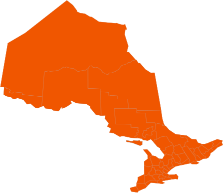
Site and Storm Weather Watch for January 8, 2024
The Paramount Service teams throughout Burlington, Oakville, Milton and Waterdown are monitoring a weather system that is forecasted for January 9th, 2024. All regions vary throughout the GTA, this system is forecasted to start around 8am and go throughout the day starting with Snow and Changing to Mixed Precipitation of Rain / Snow until around 2pm on January 9th, 2024. Environment Canada has posted a Special Weather Statement across the GTA as of 12:21pm on January 8th, 2024:
Timing:
Late Tuesday morning to Tuesday evening.
Discussion:
Snow associated with a storm system is expected to move into portions of southern Ontario on Tuesday. The snow may be heavy at times before changing to rain later in the day.
Snowfall amounts of 5 to 10 cm are possible, although amounts may be significantly lower closer to Lake Ontario where snow may change to rain sooner. Difficult travel conditions will be likely once the snow arrives. At this point, it appears that the heaviest snow will arrive after the morning commute, but that the afternoon commute could be significantly impacted.
In areas near Lake Ontario, if the snow changes to rain earlier, rainfall amounts of 20 to 40 mm appear possible. Winter weather travel advisories may be issued for some regions as this event draws nearer.
Our Snow Management teams are monitoring this system very closely and we will update this site with the plan of attack on how our teams are going to service this storm. Please check back to this site for service level updates for all regions as well as weather updates.
Please check back to this site as well our 24 Hour Snowline at 855-906-0279 ext. 1 as updates are made to both sites throughout any weather episode. For any questions or concerns regarding your properties please reach out to us via email as phones and voicemails are not monitored regularly. Please email [email protected] as this email is monitored throughout the winter months.
-
Overcast
-
Temperature 4oC
-
On Time
The Paramount Service teams throughout Hamilton, Stoney Creek and Brantford are monitoring a weather system that is forecasted for January 9th, 2024. All regions vary throughout the GTA, this system is forecasted to start around 8am and go throughout the day starting with Snow and Changing to Mixed Precipitation of Rain / Snow until around 2pm on January 9th, 2024. Environment Canada has posted a Special Weather Statement across the GTA as of 12:21pm on January 8th, 2024:
Timing:
Late Tuesday morning to Tuesday evening.
Discussion:
Snow associated with a storm system is expected to move into portions of southern Ontario on Tuesday. The snow may be heavy at times before changing to rain later in the day.
Snowfall amounts of 5 to 10 cm are possible, although amounts may be significantly lower closer to Lake Ontario where snow may change to rain sooner. Difficult travel conditions will be likely once the snow arrives. At this point, it appears that the heaviest snow will arrive after the morning commute, but that the afternoon commute could be significantly impacted.
In areas near Lake Ontario, if the snow changes to rain earlier, rainfall amounts of 20 to 40 mm appear possible. Winter weather travel advisories may be issued for some regions as this event draws nearer.
Our Snow Management teams are monitoring this system very closely and we will update this site with the plan of attack on how our teams are going to service this storm. Please check back to this site for service level updates for all regions as well as weather updates.
Please check back to this site as well our 24 Hour Snowline at 855-906-0279 ext 1 as updates are made to both sites throughout any weather episode. For any questions or concerns regarding your properties please reach out to us via email as phones and voicemails are not monitored regularly. Please email [email protected] as this email is monitored throughout the winter months.
-
Overcast
-
Temperature 4oC
-
On Time
The Paramount Service teams throughout Guelph, Kitchener, Waterloo and Cambridge are monitoring a weather system that is forecasted for January 9th, 2024. All regions vary throughout the GTA, this system is forecasted to start around 8am and go throughout the day starting with Snow and Changing to Mixed Precipitation of Rain / Snow until around 2pm on January 9th, 2024. Environment Canada has posted a Special Weather Statement across the GTA as of 12:21pm on January 8th, 2024:
Timing:
Late Tuesday morning to Tuesday evening.
Discussion:
Snow associated with a storm system is expected to move into portions of southern Ontario on Tuesday. The snow may be heavy at times before changing to rain later in the day.
Snowfall amounts of 5 to 10 cm are possible, although amounts may be significantly lower closer to Lake Ontario where snow may change to rain sooner. Difficult travel conditions will be likely once the snow arrives. At this point, it appears that the heaviest snow will arrive after the morning commute, but that the afternoon commute could be significantly impacted.
In areas near Lake Ontario, if the snow changes to rain earlier, rainfall amounts of 20 to 40 mm appear possible. Winter weather travel advisories may be issued for some regions as this event draws nearer.
Our Snow Management teams are monitoring this system very closely and we will update this site with the plan of attack on how our teams are going to service this storm. Please check back to this site for service level updates for all regions as well as weather updates.
Please check back to this site as well our 24 Hour Snowline at 855-906-0279 ext 2 as updates are made to both sites throughout any weather episode. For any questions or concerns regarding your properties please reach out to us via email as phones and voicemails are not monitored regularly. Please email [email protected] as this email is monitored throughout the winter months.
-
Overcast
-
Temperature 2oC
-
On Time
The Paramount Service teams throughout Toronto, Scarborough and Markham are monitoring a weather system that is forecasted for January 9th, 2024. All regions vary throughout the GTA, this system is forecasted to start around 8am and go throughout the day starting with Snow and Changing to Mixed Precipitation of Rain / Snow until around 2pm on January 9th, 2024. Environment Canada has posted a Special Weather Statement across the GTA as of 12:21pm on January 8th, 2024:
Timing:
Late Tuesday morning to Tuesday evening.
Discussion:
Snow associated with a storm system is expected to move into portions of southern Ontario on Tuesday. The snow may be heavy at times before changing to rain later in the day.
Snowfall amounts of 5 to 10 cm are possible, although amounts may be significantly lower closer to Lake Ontario where snow may change to rain sooner. Difficult travel conditions will be likely once the snow arrives. At this point, it appears that the heaviest snow will arrive after the morning commute, but that the afternoon commute could be significantly impacted.
In areas near Lake Ontario, if the snow changes to rain earlier, rainfall amounts of 20 to 40 mm appear possible. Winter weather travel advisories may be issued for some regions as this event draws nearer.
Our Snow Management teams are monitoring this system very closely and we will update this site with the plan of attack on how our teams are going to service this storm. Please check back to this site for service level updates for all regions as well as weather updates.
Please check back to this site as well our 24 Hour Snowline at 855-906-0279 ext 1 as updates are made to both sites throughout any weather episode. For any questions or concerns regarding your properties please reach out to us via email as phones and voicemails are not monitored regularly. Please email [email protected] as this email is monitored throughout the winter months.
-
Overcast
-
Temperature 3oC
-
On Time
The Paramount Service teams throughout Mississauga, Brampton and Georgetown are monitoring a weather system that is forecasted for January 9th, 2024. All regions vary throughout the GTA, this system is forecasted to start around 8am and go throughout the day starting with Snow and Changing to Mixed Precipitation of Rain / Snow until around 2pm on January 9th, 2024. Environment Canada has posted a Special Weather Statement across the GTA as of 12:21pm on January 8th, 2024:
Timing:
Late Tuesday morning to Tuesday evening.
Discussion:
Snow associated with a storm system is expected to move into portions of southern Ontario on Tuesday. The snow may be heavy at times before changing to rain later in the day.
Snowfall amounts of 5 to 10 cm are possible, although amounts may be significantly lower closer to Lake Ontario where snow may change to rain sooner. Difficult travel conditions will be likely once the snow arrives. At this point, it appears that the heaviest snow will arrive after the morning commute, but that the afternoon commute could be significantly impacted.
In areas near Lake Ontario, if the snow changes to rain earlier, rainfall amounts of 20 to 40 mm appear possible. Winter weather travel advisories may be issued for some regions as this event draws nearer.
Our Snow Management teams are monitoring this system very closely and we will update this site with the plan of attack on how our teams are going to service this storm. Please check back to this site for service level updates for all regions as well as weather updates.
Please check back to this site as well our 24 Hour Snowline at 855-906-0279 ext 1 as updates are made to both sites throughout any weather episode. For any questions or concerns regarding your properties please reach out to us via email as phones and voicemails are not monitored regularly. Please email [email protected] as this email is monitored throughout the winter months.
-
Overcast
-
Temperature 3oC
-
On Time
The Paramount Service teams throughout Oshawa and Ajax are monitoring a weather system that is forecasted for January 9th, 2024. All regions vary throughout the GTA, this system is forecasted to start around 8am and go throughout the day starting with Snow and Changing to Mixed Precipitation of Rain / Snow until around 2pm on January 9th, 2024. Environment Canada has posted a Special Weather Statement across the GTA as of 12:21pm on January 8th, 2024:
Timing:
Late Tuesday morning to Tuesday evening.
Discussion:
Snow associated with a storm system is expected to move into portions of southern Ontario on Tuesday. The snow may be heavy at times before changing to rain later in the day.
Snowfall amounts of 5 to 10 cm are possible, although amounts may be significantly lower closer to Lake Ontario where snow may change to rain sooner. Difficult travel conditions will be likely once the snow arrives. At this point, it appears that the heaviest snow will arrive after the morning commute, but that the afternoon commute could be significantly impacted.
In areas near Lake Ontario, if the snow changes to rain earlier, rainfall amounts of 20 to 40 mm appear possible. Winter weather travel advisories may be issued for some regions as this event draws nearer.
Our Snow Management teams are monitoring this system very closely and we will update this site with the plan of attack on how our teams are going to service this storm. Please check back to this site for service level updates for all regions as well as weather updates.
Please check back to this site as well our 24 Hour Snowline at 855-906-0279 ext 1 as updates are made to both sites throughout any weather episode. For any questions or concerns regarding your properties please reach out to us via email as phones and voicemails are not monitored regularly. Please email [email protected] as this email is monitored throughout the winter months.
-
Mostly Cloudy
-
Temperature 3oC
-
On Time
The Paramount Service teams throughout Woodstock and London are monitoring a weather system that is forecasted for January 9th, 2024. All regions vary throughout the GTA, this system is forecasted to start around 8am and go throughout the day starting with Snow and Changing to Mixed Precipitation of Rain / Snow until around 2pm on January 9th, 2024. Environment Canada has posted a Special Weather Statement across the GTA as of 12:21pm on January 8th, 2024:
Timing:
Late Tuesday morning to Tuesday evening.
Discussion:
Snow associated with a storm system is expected to move into portions of southern Ontario on Tuesday. The snow may be heavy at times before changing to rain later in the day.
Snowfall amounts of 5 to 10 cm are possible, although amounts may be significantly lower closer to Lake Ontario where snow may change to rain sooner. Difficult travel conditions will be likely once the snow arrives. At this point, it appears that the heaviest snow will arrive after the morning commute, but that the afternoon commute could be significantly impacted.
In areas near Lake Ontario, if the snow changes to rain earlier, rainfall amounts of 20 to 40 mm appear possible. Winter weather travel advisories may be issued for some regions as this event draws nearer.
Our Snow Management teams are monitoring this system very closely and we will update this site with the plan of attack on how our teams are going to service this storm. Please check back to this site for service level updates for all regions as well as weather updates.
Please check back to this site as well our 24 Hour Snowline at 855-906-0279 ext 1 as updates are made to both sites throughout any weather episode. For any questions or concerns regarding your properties please reach out to us via email as phones and voicemails are not monitored regularly. Please email [email protected] as this email is monitored throughout the winter months.
-
Overcast
-
Temperature 2oC
-
On Time