Locally Owned and Canadian made
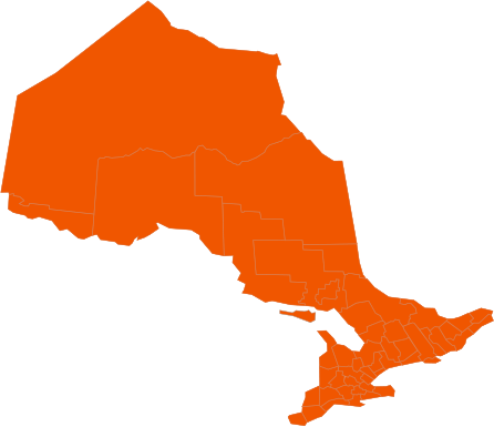
Winter Storm Watch December 23, 2022
The Paramount Service teams throughout Burlington, Oakville, Milton and Waterdown will be monitoring this winter storm that is in effect for all regions within the GTA. See below our message to our clients from our Snowline Management Staff:
Looks like we have a messy storm coming our way. The current storm track below is going to be a messy one and will effect the driving conditions over the next couple days and into the holidays. If you need to travel be safe out there. We are currently under a Winter Storm Warning issued by Environment Canada through all of our regions.
Winter Storm Warning
Issued at 14:13 Thursday 22 December 2022
Major winter storm expected Friday and Saturday.
Travel will become hazardous.
Hazards:
Wind gusts up to 90 km/h creating widespread blowing snow which will reduce visibility to near zero at times.
Snowfall amounts of 5 to 15 cm by Saturday morning.
Wind chill values into the minus twenties.
Flash freeze producing icy and slippery surfaces.
Timing:
Damaging winds and widespread blowing snow developing Friday morning and continuing into Saturday.
Snow developing Friday morning and tapering off to flurries Saturday morning.
Very cold wind chill values will develop on Friday and persist into the weekend.
Flash freeze possible Friday morning.
Discussion:
Precipitation is expected to begin as rain or snow late this afternoon or early this evening before transitioning to rain for many areas tonight. Temperatures are expected to plummet on Friday morning leading to a potential flash freeze. Rapidly falling temperatures will be accompanied by damaging winds, snow at times heavy, and widespread blowing snow. Total snowfall amounts of 5 to 15 cm is expected before the snow tapers off to flurries Saturday morning.
###
Visibility will be suddenly reduced to near zero at times in heavy snow and blowing snow.
Please continue to monitor alerts and forecasts issued by Environment Canada. To report severe weather, send an email to [email protected] or tweet reports using #ONStorm.
The time frame of the storm in general is Thursday evening 7:00pm through to Saturday 4:00pm
Rain fall accumulations from 10-15mm Thursday night and Snow fall starting Friday morning as temperatures drop quickly and continue into Saturday morning with accumulations of 5-15cm. This storm will have sustained winds of 50km and gust into the 70km causing drifting snow and windchills into the minus 20 degrees.
We will be working in and around the holidays. Respectfully we will be servicing within our contractual guidelines as well as try to get our staff home for Christmas morning with there family’s before returning to clean up properties again for December 26th.
Our plans for this storm are that we will be out Friday December 23rd morning for a salt run as the temperatures begin to fall and the rain is changing to snow in order to combat the initial freeze. Depending on how much snow falls in each region, could be followed by a possible plow run Friday afternoon/evening followed by another salt run for Saturday December 24th morning.
Please expect our service to be within our contract timelines, we’ll do our best to be ahead of them. Understand that we will be plowing and salting at various times through this 24-48 hour timeline and will not necessarily be at your property first thing.
Again be safe and thank you for all the support we have had during these big storms, it means a lot to the team and our ownership
Please note, if there is anything you require do not hesitate to contact the snowline at 855-906-0279 ext 1 or [email protected]. All emails must go to the snowline for a timely response as other emails are not monitored regularly during the winter months.
Please check back to this site as well our 24 Hour Snowline at 855-906-0279 ext 1 as updates are made to both sites throughout any weather episode. For any questions or concerns regarding your properties please reach out to us via email as phones and voicemails are not monitored regularly. Please email [email protected] as this email is monitored throughout the winter months.
-
Overcast
-
Temperature 4oC
-
On Time
The Paramount Service teams throughout Hamilton, Stoney Creek and Brantford
will be monitoring this winter storm that is in effect for all regions within the GTA. See below our message to our clients from our Snowline Management Staff:
Looks like we have a messy storm coming our way. The current storm track below is going to be a messy one and will effect the driving conditions over the next couple days and into the holidays. If you need to travel be safe out there. We are currently under a Winter Storm Warning issued by Environment Canada through all of our regions.
Winter Storm Warning
Issued at 14:13 Thursday 22 December 2022
Major winter storm expected Friday and Saturday.
Travel will become hazardous.
Hazards:
Wind gusts up to 90 km/h creating widespread blowing snow which will reduce visibility to near zero at times.
Snowfall amounts of 5 to 15 cm by Saturday morning.
Wind chill values into the minus twenties.
Flash freeze producing icy and slippery surfaces.
Timing:
Damaging winds and widespread blowing snow developing Friday morning and continuing into Saturday.
Snow developing Friday morning and tapering off to flurries Saturday morning.
Very cold wind chill values will develop on Friday and persist into the weekend.
Flash freeze possible Friday morning.
Discussion:
Precipitation is expected to begin as rain or snow late this afternoon or early this evening before transitioning to rain for many areas tonight. Temperatures are expected to plummet on Friday morning leading to a potential flash freeze. Rapidly falling temperatures will be accompanied by damaging winds, snow at times heavy, and widespread blowing snow. Total snowfall amounts of 5 to 15 cm is expected before the snow tapers off to flurries Saturday morning.
###
Visibility will be suddenly reduced to near zero at times in heavy snow and blowing snow.
Please continue to monitor alerts and forecasts issued by Environment Canada. To report severe weather, send an email to [email protected] or tweet reports using #ONStorm.
The time frame of the storm in general is Thursday evening 7:00pm through to Saturday 4:00pm
Rain fall accumulations from 10-15mm Thursday night and Snow fall starting Friday morning as temperatures drop quickly and continue into Saturday morning with accumulations of 5-15cm. This storm will have sustained winds of 50km and gust into the 70km causing drifting snow and windchills into the minus 20 degrees.
We will be working in and around the holidays. Respectfully we will be servicing within our contractual guidelines as well as try to get our staff home for Christmas morning with there family’s before returning to clean up properties again for December 26th.
Our plans for this storm are that we will be out Friday December 23rd morning for a salt run as the temperatures begin to fall and the rain is changing to snow in order to combat the initial freeze. Depending on how much snow falls in each region, could be followed by a possible plow run Friday afternoon/evening followed by another salt run for Saturday December 24th morning.
Please expect our service to be within our contract timelines, we’ll do our best to be ahead of them. Understand that we will be plowing and salting at various times through this 24-48 hour timeline and will not necessarily be at your property first thing.
Again be safe and thank you for all the support we have had during these big storms, it means a lot to the team and our ownership
Please note, if there is anything you require do not hesitate to contact the snowline at 855-906-0279 ext 1 or [email protected]. All emails must go to the snowline for a timely response as other emails are not monitored regularly during the winter months.
Please check back to this site as well our 24 Hour Snowline at 855-906-0279 ext 1 as updates are made to both sites throughout any weather episode. For any questions or concerns regarding your properties please reach out to us via email as phones and voicemails are not monitored regularly. Please email [email protected] as this email is monitored throughout the winter months.
-
Rain
-
Temperature 3oC
-
On Time
The Paramount Service teams throughout Guelph, Kitchener, Waterloo, and Cambridge
will be monitoring this winter storm that is in effect for all regions within the GTA. See below our message to our clients from our Snowline Management Staff:
Looks like we have a messy storm coming our way. The current storm track below is going to be a messy one and will effect the driving conditions over the next couple days and into the holidays. If you need to travel be safe out there. We are currently under a Winter Storm Warning issued by Environment Canada through all of our regions.
Winter Storm Warning
Issued at 14:13 Thursday 22 December 2022
Major winter storm expected Friday and Saturday.
Travel will become hazardous.
Hazards:
Wind gusts up to 90 km/h creating widespread blowing snow which will reduce visibility to near zero at times.
Snowfall amounts of 5 to 15 cm by Saturday morning.
Wind chill values into the minus twenties.
Flash freeze producing icy and slippery surfaces.
Timing:
Damaging winds and widespread blowing snow developing Friday morning and continuing into Saturday.
Snow developing Friday morning and tapering off to flurries Saturday morning.
Very cold wind chill values will develop on Friday and persist into the weekend.
Flash freeze possible Friday morning.
Discussion:
Precipitation is expected to begin as rain or snow late this afternoon or early this evening before transitioning to rain for many areas tonight. Temperatures are expected to plummet on Friday morning leading to a potential flash freeze. Rapidly falling temperatures will be accompanied by damaging winds, snow at times heavy, and widespread blowing snow. Total snowfall amounts of 5 to 15 cm is expected before the snow tapers off to flurries Saturday morning.
###
Visibility will be suddenly reduced to near zero at times in heavy snow and blowing snow.
Please continue to monitor alerts and forecasts issued by Environment Canada. To report severe weather, send an email to [email protected] or tweet reports using #ONStorm.
The time frame of the storm in general is Thursday evening 7:00pm through to Saturday 4:00pm
Rain fall accumulations from 10-15mm Thursday night and Snow fall starting Friday morning as temperatures drop quickly and continue into Saturday morning with accumulations of 5-15cm. This storm will have sustained winds of 50km and gust into the 70km causing drifting snow and windchills into the minus 20 degrees.
We will be working in and around the holidays. Respectfully we will be servicing within our contractual guidelines as well as try to get our staff home for Christmas morning with there family’s before returning to clean up properties again for December 26th.
Our plans for this storm are that we will be out Friday December 23rd morning for a salt run as the temperatures begin to fall and the rain is changing to snow in order to combat the initial freeze. Depending on how much snow falls in each region, could be followed by a possible plow run Friday afternoon/evening followed by another salt run for Saturday December 24th morning.
Please expect our service to be within our contract timelines, we’ll do our best to be ahead of them. Understand that we will be plowing and salting at various times through this 24-48 hour timeline and will not necessarily be at your property first thing.
Again be safe and thank you for all the support we have had during these big storms, it means a lot to the team and our ownership
Please note, if there is anything you require do not hesitate to contact the snowline at 855-906-0279 ext 2 or [email protected]. All emails must go to the snowline for a timely response as other emails are not monitored regularly during the winter months.
Please check back to this site as well our 24 Hour Snowline at 855-906-0279 ext 2 as updates are made to both sites throughout any weather episode. For any questions or concerns regarding your properties please reach out to us via email as phones and voicemails are not monitored regularly. Please email [email protected] as this email is monitored throughout the winter months.
-
Overcast
-
Temperature 1oC
-
On Time
The Paramount Service teams throughout Toronto, Scarborough and Markham
will be monitoring this winter storm that is in effect for all regions within the GTA. See below our message to our clients from our Snowline Management Staff:
Looks like we have a messy storm coming our way. The current storm track below is going to be a messy one and will effect the driving conditions over the next couple days and into the holidays. If you need to travel be safe out there. We are currently under a Winter Storm Warning issued by Environment Canada through all of our regions.
Winter Storm Warning
Issued at 14:13 Thursday 22 December 2022
Major winter storm expected Friday and Saturday.
Travel will become hazardous.
Hazards:
Wind gusts up to 90 km/h creating widespread blowing snow which will reduce visibility to near zero at times.
Snowfall amounts of 5 to 15 cm by Saturday morning.
Wind chill values into the minus twenties.
Flash freeze producing icy and slippery surfaces.
Timing:
Damaging winds and widespread blowing snow developing Friday morning and continuing into Saturday.
Snow developing Friday morning and tapering off to flurries Saturday morning.
Very cold wind chill values will develop on Friday and persist into the weekend.
Flash freeze possible Friday morning.
Discussion:
Precipitation is expected to begin as rain or snow late this afternoon or early this evening before transitioning to rain for many areas tonight. Temperatures are expected to plummet on Friday morning leading to a potential flash freeze. Rapidly falling temperatures will be accompanied by damaging winds, snow at times heavy, and widespread blowing snow. Total snowfall amounts of 5 to 15 cm is expected before the snow tapers off to flurries Saturday morning.
###
Visibility will be suddenly reduced to near zero at times in heavy snow and blowing snow.
Please continue to monitor alerts and forecasts issued by Environment Canada. To report severe weather, send an email to [email protected] or tweet reports using #ONStorm.
The time frame of the storm in general is Thursday evening 7:00pm through to Saturday 4:00pm
Rain fall accumulations from 10-15mm Thursday night and Snow fall starting Friday morning as temperatures drop quickly and continue into Saturday morning with accumulations of 5-15cm. This storm will have sustained winds of 50km and gust into the 70km causing drifting snow and windchills into the minus 20 degrees.
We will be working in and around the holidays. Respectfully we will be servicing within our contractual guidelines as well as try to get our staff home for Christmas morning with there family’s before returning to clean up properties again for December 26th.
Our plans for this storm are that we will be out Friday December 23rd morning for a salt run as the temperatures begin to fall and the rain is changing to snow in order to combat the initial freeze. Depending on how much snow falls in each region, could be followed by a possible plow run Friday afternoon/evening followed by another salt run for Saturday December 24th morning.
Please expect our service to be within our contract timelines, we’ll do our best to be ahead of them. Understand that we will be plowing and salting at various times through this 24-48 hour timeline and will not necessarily be at your property first thing.
Again be safe and thank you for all the support we have had during these big storms, it means a lot to the team and our ownership
Please note, if there is anything you require do not hesitate to contact the snowline at 855-906-0279 ext 1 or [email protected]. All emails must go to the snowline for a timely response as other emails are not monitored regularly during the winter months.
Please check back to this site as well our 24 Hour Snowline at 855-906-0279 ext 1 as updates are made to both sites throughout any weather episode. For any questions or concerns regarding your properties please reach out to us via email as phones and voicemails are not monitored regularly. Please email [email protected] as this email is monitored throughout the winter months.
-
Light Rain
-
Temperature 4oC
-
On Time
The Paramount Service teams throughout Mississauga and Brampton
will be monitoring this winter storm that is in effect for all regions within the GTA. See below our message to our clients from our Snowline Management Staff:
Looks like we have a messy storm coming our way. The current storm track below is going to be a messy one and will effect the driving conditions over the next couple days and into the holidays. If you need to travel be safe out there. We are currently under a Winter Storm Warning issued by Environment Canada through all of our regions.
Winter Storm Warning
Issued at 14:13 Thursday 22 December 2022
Major winter storm expected Friday and Saturday.
Travel will become hazardous.
Hazards:
Wind gusts up to 90 km/h creating widespread blowing snow which will reduce visibility to near zero at times.
Snowfall amounts of 5 to 15 cm by Saturday morning.
Wind chill values into the minus twenties.
Flash freeze producing icy and slippery surfaces.
Timing:
Damaging winds and widespread blowing snow developing Friday morning and continuing into Saturday.
Snow developing Friday morning and tapering off to flurries Saturday morning.
Very cold wind chill values will develop on Friday and persist into the weekend.
Flash freeze possible Friday morning.
Discussion:
Precipitation is expected to begin as rain or snow late this afternoon or early this evening before transitioning to rain for many areas tonight. Temperatures are expected to plummet on Friday morning leading to a potential flash freeze. Rapidly falling temperatures will be accompanied by damaging winds, snow at times heavy, and widespread blowing snow. Total snowfall amounts of 5 to 15 cm is expected before the snow tapers off to flurries Saturday morning.
###
Visibility will be suddenly reduced to near zero at times in heavy snow and blowing snow.
Please continue to monitor alerts and forecasts issued by Environment Canada. To report severe weather, send an email to [email protected] or tweet reports using #ONStorm.
The time frame of the storm in general is Thursday evening 7:00pm through to Saturday 4:00pm
Rain fall accumulations from 10-15mm Thursday night and Snow fall starting Friday morning as temperatures drop quickly and continue into Saturday morning with accumulations of 5-15cm. This storm will have sustained winds of 50km and gust into the 70km causing drifting snow and windchills into the minus 20 degrees.
We will be working in and around the holidays. Respectfully we will be servicing within our contractual guidelines as well as try to get our staff home for Christmas morning with there family’s before returning to clean up properties again for December 26th.
Our plans for this storm are that we will be out Friday December 23rd morning for a salt run as the temperatures begin to fall and the rain is changing to snow in order to combat the initial freeze. Depending on how much snow falls in each region, could be followed by a possible plow run Friday afternoon/evening followed by another salt run for Saturday December 24th morning.
Please expect our service to be within our contract timelines, we’ll do our best to be ahead of them. Understand that we will be plowing and salting at various times through this 24-48 hour timeline and will not necessarily be at your property first thing.
Again be safe and thank you for all the support we have had during these big storms, it means a lot to the team and our ownership
Please note, if there is anything you require do not hesitate to contact the snowline at 855-906-0279 ext 1 or [email protected]. All emails must go to the snowline for a timely response as other emails are not monitored regularly during the winter months.
Please check back to this site as well our 24 Hour Snowline at 855-906-0279 ext 1 as updates are made to both sites throughout any weather episode. For any questions or concerns regarding your properties please reach out to us via email as phones and voicemails are not monitored regularly. Please email [email protected] as this email is monitored throughout the winter months.
-
Light Rain
-
Temperature 3oC
-
On Time
The Paramount Service teams throughout Oshawa and Ajax
will be monitoring this winter storm that is in effect for all regions within the GTA. See below our message to our clients from our Snowline Management Staff:
Looks like we have a messy storm coming our way. The current storm track below is going to be a messy one and will effect the driving conditions over the next couple days and into the holidays. If you need to travel be safe out there. We are currently under a Winter Storm Warning issued by Environment Canada through all of our regions.
Winter Storm Warning
Issued at 14:13 Thursday 22 December 2022
Major winter storm expected Friday and Saturday.
Travel will become hazardous.
Hazards:
Wind gusts up to 90 km/h creating widespread blowing snow which will reduce visibility to near zero at times.
Snowfall amounts of 5 to 15 cm by Saturday morning.
Wind chill values into the minus twenties.
Flash freeze producing icy and slippery surfaces.
Timing:
Damaging winds and widespread blowing snow developing Friday morning and continuing into Saturday.
Snow developing Friday morning and tapering off to flurries Saturday morning.
Very cold wind chill values will develop on Friday and persist into the weekend.
Flash freeze possible Friday morning.
Discussion:
Precipitation is expected to begin as rain or snow late this afternoon or early this evening before transitioning to rain for many areas tonight. Temperatures are expected to plummet on Friday morning leading to a potential flash freeze. Rapidly falling temperatures will be accompanied by damaging winds, snow at times heavy, and widespread blowing snow. Total snowfall amounts of 5 to 15 cm is expected before the snow tapers off to flurries Saturday morning.
###
Visibility will be suddenly reduced to near zero at times in heavy snow and blowing snow.
Please continue to monitor alerts and forecasts issued by Environment Canada. To report severe weather, send an email to [email protected] or tweet reports using #ONStorm.
The time frame of the storm in general is Thursday evening 7:00pm through to Saturday 4:00pm
Rain fall accumulations from 10-15mm Thursday night and Snow fall starting Friday morning as temperatures drop quickly and continue into Saturday morning with accumulations of 5-15cm. This storm will have sustained winds of 50km and gust into the 70km causing drifting snow and windchills into the minus 20 degrees.
We will be working in and around the holidays. Respectfully we will be servicing within our contractual guidelines as well as try to get our staff home for Christmas morning with there family’s before returning to clean up properties again for December 26th.
Our plans for this storm are that we will be out Friday December 23rd morning for a salt run as the temperatures begin to fall and the rain is changing to snow in order to combat the initial freeze. Depending on how much snow falls in each region, could be followed by a possible plow run Friday afternoon/evening followed by another salt run for Saturday December 24th morning.
Please expect our service to be within our contract timelines, we’ll do our best to be ahead of them. Understand that we will be plowing and salting at various times through this 24-48 hour timeline and will not necessarily be at your property first thing.
Again be safe and thank you for all the support we have had during these big storms, it means a lot to the team and our ownership
Please note, if there is anything you require do not hesitate to contact the snowline at 855-906-0279 ext 1 or [email protected]. All emails must go to the snowline for a timely response as other emails are not monitored regularly during the winter months.
Please check back to this site as well our 24 Hour Snowline at 855-906-0279 ext 1 as updates are made to both sites throughout any weather episode. For any questions or concerns regarding your properties please reach out to us via email as phones and voicemails are not monitored regularly. Please email [email protected] as this email is monitored throughout the winter months.
-
Rain
-
Temperature 2oC
-
On Time
The Paramount Service teams throughout Fort Erie service will continue to monitor this winter storm that is on track for all sites throughout the GTA. Please see below a message to our clients from our Snowline Management Staff:
Looks like we have a messy storm coming our way. The current storm track below is going to be a messy one and will effect the driving conditions over the next couple days and into the holidays. If you need to travel be safe out there. We are currently under a Winter Storm Warning issued by Environment Canada through all of our regions.
We are currently under a Blizzard Warning issued by Environment Canada for the Fort Erie region.
Blizzard Warning
Issued at 11:14 Thursday 22 December 2022
Crippling blizzard Friday and Saturday.
Travel will become dangerous and is not advised.
Hazards:
Blizzard conditions with wind gusts of 100 to 120 km/h.
Snowfall amounts of 15 to 30 cm by Sunday morning. Locally higher amounts are possible, especially toward Fort Erie.
Wind chill values near minus 20.
Flash freeze producing icy and slippery surfaces.
Timing:
Damaging winds and blizzard conditions developing Friday morning and continuing through Saturday night.
Very cold wind chill values are expected to develop Friday and persist into the weekend.
Flash freeze possible Friday morning.
Discussion:
Precipitation will begin as rain this afternoon. Temperatures are expected to plummet on Friday morning leading to a potential flash freeze. Rapidly falling temperatures will be accompanied by damaging winds and snow heavy at times. Blizzard conditions will develop Friday, especially as lake effect snow off Lake Erie intensifies. Lake effect snow will result in variability of snowfall amounts through the weekend.
###
Visibility will be suddenly reduced to near zero at times in heavy snow and blowing snow.
Please continue to monitor alerts and forecasts issued by Environment Canada. To report severe weather, send an email to [email protected] or tweet reports using #ONStorm.
The time frame of the storm in general is Thursday evening 7:00pm through to Sunday morning.
Rain fall accumulations from 10mm Thursday night and Snow fall starting Friday morning as temperatures drop quickly and continue into Sunday morning with accumulations of 30-50cm. This storm will have sustained winds of 72km and gust into the 110km causing drifting snow and windchills into the minus 20 degrees.
We will be working in and around the holidays. Respectfully we will be servicing within our contractual guidelines as well as try to get our staff home for Christmas morning with there family’s before returning to clean up properties again for December 26th.
Our plans for this storm are that we will be out Friday December 23rd morning for a salt run as the temperatures begin to fall and the rain is changing to snow in order to combat the initial freeze. Depending on how much snow falls in each region, could be followed by a possible multiple plow and salt runs into Sunday morning.
Please expect our service to be within our Blizzard contract timelines, we’ll do our best to be ahead of them. Understand that we will be plowing and salting at various times through this 24-48 hour timeline and will not necessarily be at your property first thing.
Again be safe and thank you for all the support we have had during these big storms, it means a lot to the team and our ownership.
Please note, if there is anything you require do not hesitate to contact the snowline at 855-906-0279 ext 1 or [email protected]. All emails must go to the snowline for a timely response as other emails are not monitored regularly during the winter months.
Please check back to this site as well our 24 Hour Snowline at 855-906-0279 ext 1 as updates are made to both sites throughout any weather episode. For any questions or concerns regarding your properties please reach out to us via email as phones and voicemails are not monitored regularly. Please email [email protected] as this email is monitored throughout the winter months.
-
Rain
-
Temperature 2oC
-
On Time