Locally Owned and Canadian made
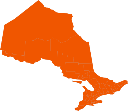
Winter Storm Update February 17, 2022
The Paramount Service teams throughout Burlington, Oakville, Milton and Waterdown have been monitoring the upcoming weather system for all regions. The current storm track below is going to be a messy one and will affect the drive home Thursday evening. If you need to travel, be safe out there, if you have the opportunity to leave work a couple hours early and be off the roads before 5pm this would the safest plan of action. We are currently under a Special Weather Statement and a Snowfall Warning issued by Environment Canada through all our regions.
Special Weather Statement Issued at 16:34 Wednesday 16 February 2022
Summary:Significant rainfall expected tonight into Thursday afternoon.
Hazards:Rain. Total rainfall amounts of 10 to 25 mm possible by Thursday afternoon.
When:This evening through Thursday afternoon.
Discussion:A low-pressure system is expected to track northeast across Lake Erie and Lake Ontario Thursday night which will bring a messy mix of wintry precipitation to southern Ontario. Precipitation will likely begin as rain this evening and transition to snow Thursday morning or afternoon. At this time the track of this low-pressure system is uncertain, and as such precipitation timing and amounts may change.
Snowfall Warning Issued at 15:53 Wednesday 16 February 2022
Snowfall with total amounts of 10 to 20 cm is expected.
Hazards:Snow, at times heavy, Thursday afternoon through Friday morning. Total snowfall accumulations of 10 to 20 cm possible.
Reduced visibility in heavy snow and blowing snow. Icy and slippery surfaces.
When:Thursday February 17th beginning in the afternoon through Friday February 18th morning.
Discussion:A low-pressure system is expected to track northeast across Lake Erie and Lake Ontario Thursday night which will bring a messy mix of wintry precipitation to southern Ontario. Precipitation will begin as rain this evening and transition to snow Thursday afternoon. Freezing rain and ice pellets are also possible Thursday morning and afternoon.
As the track of the low-pressure system remains uncertain, precipitation timing and amounts may change. Rapidly accumulating snow could make travel difficult over some locations. Visibility may be suddenly reduced at times in heavy snow. Surfaces such as highways, roads, walkways, and parking lots may become difficult to navigate due to accumulating snow.
The time frame of the storm in general is Wednesday evening 7:00pm through to Friday morning 4:00am
Rain fall accumulations from 15-25mm on Wednesday and 15-20cm Thursday evening going into Friday morning. We could see 20 plus cm on the ground by Thursday overnight in the GTA.
This storm will have an extended period of mixed precipitation, Rain, Ice pellets, freezing rain and Snow starting early Wednesday evening and into Friday morning. The snow will come fast and hard Thursday evening, we could see accumulations of 2-4cm per hour.
Our plans for this storm are that we will be out for a plow run starting at 11:00pm Thursday February 17th. Immediately followed by a salt run Friday morning Starting before 7:00am
Please expect our service to be within our contract timelines, we’ll do our best to be ahead of them. Understand that with the hourly rate of snowfall in such a short period of time, we will be plowing through this timeline and will not necessarily be at your property first thing. There could be as much as 10-15cm on your property before we visit.
A lot of you have had us move and relocate snow which has alleviated room to pile this upcoming storm’s snow accumulation. Some sites did not have the capability to have removals or relocations done. On these sites, it could be very tricky for snow placement, and we will do our best to not block anything but keep in mind that after this one a snow removal/ allocation may be imminent on those lots for the next storm which is forecasted next week. Our teams will be available as of Saturday morning to start doing these services again please call asap if you need this done to book a spot in our schedule.
Again, be safe and thank you for all the support we have had during these big storms, it means a lot to the team and our ownership.
Please note, if there is anything you require do not hesitate to contact the snowline at 855-906-0279 ext 2 or [email protected]. All emails must go to the snowline for a timely response as other emails are not monitored regularly during the winter months. Please check back to this site as well our 24 Hour Snowline at 855-906-0279 ext 2 as updates are made to both sites throughout any weather episode. For any questions or concerns regarding your properties please reach out to us via email as phones and voicemails are not monitored regularly. Please email [email protected] as this email is monitored throughout the winter months.
-
Overcast
-
Temperature 8oC
-
On Time
The Paramount Service teams throughout Hamilton, Stoney Creek and Brantford have been monitoring the upcoming weather system for all regions. The current storm track below is going to be a messy one and will affect the drive home Thursday evening. If you need to travel, be safe out there, if you have the opportunity to leave work a couple hours early and be off the roads before 5pm this would the safest plan of action. We are currently under a Special Weather Statement and a Snowfall Warning issued by Environment Canada through all our regions.
Special Weather Statement Issued at 16:34 Wednesday 16 February 2022
Summary:Significant rainfall expected tonight into Thursday afternoon.
Hazards:Rain. Total rainfall amounts of 10 to 25 mm possible by Thursday afternoon.
When:This evening through Thursday afternoon.
Discussion:A low-pressure system is expected to track northeast across Lake Erie and Lake Ontario Thursday night which will bring a messy mix of wintry precipitation to southern Ontario. Precipitation will likely begin as rain this evening and transition to snow Thursday morning or afternoon. At this time the track of this low-pressure system is uncertain, and as such precipitation timing and amounts may change.
Snowfall Warning Issued at 15:53 Wednesday 16 February 2022
Snowfall with total amounts of 10 to 20 cm is expected.
Hazards:Snow, at times heavy, Thursday afternoon through Friday morning. Total snowfall accumulations of 10 to 20 cm possible.
Reduced visibility in heavy snow and blowing snow. Icy and slippery surfaces.
When:Thursday February 17th beginning in the afternoon through Friday February 18th morning.
Discussion:A low-pressure system is expected to track northeast across Lake Erie and Lake Ontario Thursday night which will bring a messy mix of wintry precipitation to southern Ontario. Precipitation will begin as rain this evening and transition to snow Thursday afternoon. Freezing rain and ice pellets are also possible Thursday morning and afternoon.
As the track of the low-pressure system remains uncertain, precipitation timing and amounts may change. Rapidly accumulating snow could make travel difficult over some locations. Visibility may be suddenly reduced at times in heavy snow. Surfaces such as highways, roads, walkways, and parking lots may become difficult to navigate due to accumulating snow.
The time frame of the storm in general is Wednesday evening 7:00pm through to Friday morning 4:00am
Rain fall accumulations from 15-25mm on Wednesday and 15-20cm Thursday evening going into Friday morning. We could see 20 plus cm on the ground by Thursday overnight in the GTA.
This storm will have an extended period of mixed precipitation, Rain, Ice pellets, freezing rain and Snow starting early Wednesday evening and into Friday morning. The snow will come fast and hard Thursday evening, we could see accumulations of 2-4cm per hour.
Our plans for this storm are that we will be out for a plow run starting at 11:00pm Thursday February 17th. Immediately followed by a salt run Friday morning Starting before 7:00am
Please expect our service to be within our contract timelines, we’ll do our best to be ahead of them. Understand that with the hourly rate of snowfall in such a short period of time, we will be plowing through this timeline and will not necessarily be at your property first thing. There could be as much as 10-15cm on your property before we visit.
A lot of you have had us move and relocate snow which has alleviated room to pile this upcoming storm’s snow accumulation. Some sites did not have the capability to have removals or relocations done. On these sites, it could be very tricky for snow placement, and we will do our best to not block anything but keep in mind that after this one a snow removal/ allocation may be imminent on those lots for the next storm which is forecasted next week. Our teams will be available as of Saturday morning to start doing these services again please call asap if you need this done to book a spot in our schedule.
Again, be safe and thank you for all the support we have had during these big storms, it means a lot to the team and our ownership.
Please note, if there is anything you require do not hesitate to contact the snowline at 855-906-0279 ext 2 or [email protected]. All emails must go to the snowline for a timely response as other emails are not monitored regularly during the winter months. Please check back to this site as well our 24 Hour Snowline at 855-906-0279 ext 2 as updates are made to both sites throughout any weather episode. For any questions or concerns regarding your properties please reach out to us via email as phones and voicemails are not monitored regularly. Please email [email protected] as this email is monitored throughout the winter months.
-
Light Drizzle
-
Temperature 8oC
-
On Time
The Paramount Service teams throughout Guelph, Kitchener, Waterloo and Cambridge have been monitoring the upcoming weather system for all regions. The current storm track below is going to be a messy one and will affect the drive home Thursday evening. If you need to travel, be safe out there, if you have the opportunity to leave work a couple hours early and be off the roads before 5pm this would the safest plan of action. We are currently under a Special Weather Statement and a Snowfall Warning issued by Environment Canada through all our regions.
Special Weather Statement Issued at 16:34 Wednesday 16 February 2022
Summary:Significant rainfall expected tonight into Thursday afternoon.
Hazards:Rain. Total rainfall amounts of 10 to 25 mm possible by Thursday afternoon.
When:This evening through Thursday afternoon.
Discussion:A low-pressure system is expected to track northeast across Lake Erie and Lake Ontario Thursday night which will bring a messy mix of wintry precipitation to southern Ontario. Precipitation will likely begin as rain this evening and transition to snow Thursday morning or afternoon. At this time the track of this low-pressure system is uncertain, and as such precipitation timing and amounts may change.
Snowfall Warning Issued at 15:53 Wednesday 16 February 2022
with total amounts of 10 to 20 cm is expected.
Hazards:Snow, at times heavy, Thursday afternoon through Friday morning. Total snowfall accumulations of 10 to 20 cm possible.
Reduced visibility in heavy snow and blowing snow.Icy and slippery surfaces.
When:Thursday February 17th beginning in the afternoon through Friday February 18th morning.
Discussion:A low-pressure system is expected to track northeast across Lake Erie and Lake Ontario Thursday night which will bring a messy mix of wintry precipitation to southern Ontario. Precipitation will begin as rain this evening and transition to snow Thursday afternoon. Freezing rain and ice pellets are also possible Thursday morning and afternoon.
As the track of the low-pressure system remains uncertain, precipitation timing and amounts may change. Rapidly accumulating snow could make travel difficult over some locations. Visibility may be suddenly reduced at times in heavy snow. Surfaces such as highways, roads, walkways, and parking lots may become difficult to navigate due to accumulating snow.
The time frame of the storm in general is Wednesday evening 7:00pm through to Friday morning 4:00am
Rain fall accumulations from 15-25mm on Wednesday and 15-20cm Thursday evening going into Friday morning. We could see 20 plus cm on the ground by Thursday overnight in the GTA.
This storm will have an extended period of mixed precipitation, Rain, Ice pellets, freezing rain and Snow starting early Wednesday evening and into Friday morning. The snow will come fast and hard Thursday evening, we could see accumulations of 2-4cm per hour.
Our plans for this storm are that we will be out for a plow run starting at 11:00pm Thursday February 17th. Immediately followed by a salt run Friday morning Starting before 7:00am
Please expect our service to be within our contract timelines, we’ll do our best to be ahead of them. Understand that with the hourly rate of snowfall in such a short period of time, we will be plowing through this timeline and will not necessarily be at your property first thing. There could be as much as 10-15cm on your property before we visit.
A lot of you have had us move and relocate snow which has alleviated room to pile this upcoming storm’s snow accumulation. Some sites did not have the capability to have removals or relocations done. On these sites, it could be very tricky for snow placement, and we will do our best to not block anything but keep in mind that after this one a snow removal/ allocation may be imminent on those lots for the next storm which is forecasted next week. Our teams will be available as of Saturday morning to start doing these services again please call asap if you need this done to book a spot in our schedule.
Again, be safe and thank you for all the support we have had during these big storms, it means a lot to the team and our ownership.
Please note, if there is anything you require do not hesitate to contact the snowline at 855-906-0279 ext 2 or [email protected]. All emails must go to the snowline for a timely response as other emails are not monitored regularly during the winter months. Please check back to this site as well our 24 Hour Snowline at 855-906-0279 ext 2 as updates are made to both sites throughout any weather episode. For any questions or concerns regarding your properties please reach out to us via email as phones and voicemails are not monitored regularly. Please email [email protected] as this email is monitored throughout the winter months.
-
Overcast
-
Temperature 1oC
-
On Time
The Paramount Service teams throughout Toronto, Scarborough and Markham have been monitoring the upcoming weather system for all regions. The current storm track below is going to be a messy one and will affect the drive home Thursday evening. If you need to travel, be safe out there, if you have the opportunity to leave work a couple hours early and be off the roads before 5pm this would the safest plan of action. We are currently under a Special Weather Statement and a Snowfall Warning issued by Environment Canada through all our regions.
Special Weather Statement Issued at 16:34 Wednesday 16 February 2022
Summary:Significant rainfall expected tonight into Thursday afternoon.
Hazards:Rain. Total rainfall amounts of 10 to 25 mm possible by Thursday afternoon.
When:This evening through Thursday afternoon.
Discussion:A low-pressure system is expected to track northeast across Lake Erie and Lake Ontario Thursday night which will bring a messy mix of wintry precipitation to southern Ontario. Precipitation will likely begin as rain this evening and transition to snow Thursday morning or afternoon. At this time the track of this low-pressure system is uncertain, and as such precipitation timing and amounts may change.
Snowfall Warning Issued at 15:53 Wednesday 16 February 2022
Snowfall with total amounts of 10 to 20 cm is expected.
Hazards:Snow, at times heavy, Thursday afternoon through Friday morning. Total snowfall accumulations of 10 to 20 cm possible.
Reduced visibility in heavy snow and blowing snow. Icy and slippery surfaces.
When:Thursday February 17th beginning in the afternoon through Friday February 18th morning.
Discussion:A low-pressure system is expected to track northeast across Lake Erie and Lake Ontario Thursday night which will bring a messy mix of wintry precipitation to southern Ontario. Precipitation will begin as rain this evening and transition to snow Thursday afternoon. Freezing rain and ice pellets are also possible Thursday morning and afternoon.
As the track of the low-pressure system remains uncertain, precipitation timing and amounts may change. Rapidly accumulating snow could make travel difficult over some locations. Visibility may be suddenly reduced at times in heavy snow. Surfaces such as highways, roads, walkways, and parking lots may become difficult to navigate due to accumulating snow.
The time frame of the storm in general is Wednesday evening 7:00pm through to Friday morning 4:00am
Rain fall accumulations from 15-25mm on Wednesday and 15-20cm Thursday evening going into Friday morning. We could see 20 plus cm on the ground by Thursday overnight in the GTA.
This storm will have an extended period of mixed precipitation, Rain, Ice pellets, freezing rain and Snow starting early Wednesday evening and into Friday morning. The snow will come fast and hard Thursday evening, we could see accumulations of 2-4cm per hour.
Our plans for this storm are that we will be out for a plow run starting at 11:00pm Thursday February 17th. Immediately followed by a salt run Friday morning Starting before 7:00am
Please expect our service to be within our contract timelines, we’ll do our best to be ahead of them. Understand that with the hourly rate of snowfall in such a short period of time, we will be plowing through this timeline and will not necessarily be at your property first thing. There could be as much as 10-15cm on your property before we visit.
A lot of you have had us move and relocate snow which has alleviated room to pile this upcoming storm’s snow accumulation. Some sites did not have the capability to have removals or relocations done. On these sites, it could be very tricky for snow placement, and we will do our best to not block anything but keep in mind that after this one a snow removal/ allocation may be imminent on those lots for the next storm which is forecasted next week. Our teams will be available as of Saturday morning to start doing these services again please call asap if you need this done to book a spot in our schedule.
Again, be safe and thank you for all the support we have had during these big storms, it means a lot to the team and our ownership.
Please note, if there is anything you require do not hesitate to contact the snowline at 855-906-0279 ext 2 or [email protected]. All emails must go to the snowline for a timely response as other emails are not monitored regularly during the winter months.
Please check back to this site as well our 24 Hour Snowline at 855-906-0279 ext 2 as updates are made to both sites throughout any weather episode. For any questions or concerns regarding your properties please reach out to us via email as phones and voicemails are not monitored regularly. Please email [email protected] as this email is monitored throughout the winter months.
-
Light Rain
-
Temperature 2oC
-
On Time
The Paramount Service teams throughout Mississauga and Brampton have been monitoring the upcoming weather system for all regions. The current storm track below is going to be a messy one and will affect the drive home Thursday evening. If you need to travel, be safe out there, if you have the opportunity to leave work a couple hours early and be off the roads before 5pm this would the safest plan of action. We are currently under a Special Weather Statement and a Snowfall Warning issued by Environment Canada through all our regions.
Special Weather Statement Issued at 16:34 Wednesday 16 February 2022
Summary:Significant rainfall expected tonight into Thursday afternoon.
Hazards:Rain. Total rainfall amounts of 10 to 25 mm possible by Thursday afternoon.
When:This evening through Thursday afternoon.
Discussion:A low-pressure system is expected to track northeast across Lake Erie and Lake Ontario Thursday night which will bring a messy mix of wintry precipitation to southern Ontario. Precipitation will likely begin as rain this evening and transition to snow Thursday morning or afternoon. At this time the track of this low-pressure system is uncertain, and as such precipitation timing and amounts may change.
Snowfall Warning Issued at 15:53 Wednesday 16 February 2022
Snowfall with total amounts of 10 to 20 cm is expected.
Hazards:Snow,at times heavy, Thursday afternoon through Friday morning. Total snowfall accumulations of 10 to 20 cm possible.
Reduced visibility in heavy snow and blowing snow. Icy and slippery surfaces.
When:Thursday February 17th beginning in the afternoon through Friday February 18th morning.
Discussion:A low-pressure system is expected to track northeast across Lake Erie and Lake Ontario Thursday night which will bring a messy mix of wintry precipitation to southern Ontario. Precipitation will begin as rain this evening and transition to snow Thursday afternoon. Freezing rain and ice pellets are also possible Thursday morning and afternoon.
The time frame of the storm in general is Wednesday evening 7:00pm through to Friday morning 4:00am
Rain fall accumulations from 15-25mm on Wednesday and 15-20cm Thursday evening going into Friday morning. We could see 20 plus cm on the ground by Thursday overnight in the GTA.
This storm will have an extended period of mixed precipitation, Rain, Ice pellets, freezing rain and Snow starting early Wednesday evening and into Friday morning. The snow will come fast and hard Thursday evening, we could see accumulations of 2-4cm per hour.
Our plans for this storm are that we will be out for a plow run starting at 11:00pm Thursday February 17th. Immediately followed by a salt run Friday morning Starting before 7:00am
Please expect our service to be within our contract timelines, we’ll do our best to be ahead of them. Understand that with the hourly rate of snowfall in such a short period of time, we will be plowing through this timeline and will not necessarily be at your property first thing. There could be as much as 10-15cm on your property before we visit.
A lot of you have had us move and relocate snow which has alleviated room to pile this upcoming storm’s snow accumulation. Some sites did not have the capability to have removals or relocations done. On these sites, it could be very tricky for snow placement, and we will do our best to not block anything but keep in mind that after this one a snow removal/ allocation may be imminent on those lots for the next storm which is forecasted next week. Our teams will be available as of Saturday morning to start doing these services again please call asap if you need this done to book a spot in our schedule.
Again, be safe and thank you for all the support we have had during these big storms, it means a lot to the team and our ownership.
Please note, if there is anything you require do not hesitate to contact the snowline at 855-906-0279 ext 2 or [email protected]. All emails must go to the snowline for a timely response as other emails are not monitored regularly during the winter months. Please check back to this site as well our 24 Hour Snowline at 855-906-0279 ext 2 as updates are made to both sites throughout any weather episode. For any questions or concerns regarding your properties please reach out to us via email as phones and voicemails are not monitored regularly. Please email [email protected] as this email is monitored throughout the winter months.
-
Light Rain
-
Temperature 1oC
-
On Time
The Paramount Service teams throughout Oshawa and Ajax have been monitoring the upcoming weather system for all regions. The current storm track below is going to be a messy one and will affect the drive home Thursday evening. If you need to travel, be safe out there, if you have the opportunity to leave work a couple hours early and be off the roads before 5pm this would the safest plan of action. We are currently under a Special Weather Statement and a Snowfall Warning issued by Environment Canada through all our regions.
Special Weather Statement Issued at 16:34 Wednesday 16 February 2022
Summary:Significant rainfall expected tonight into Thursday afternoon.
Hazards:Rain. Total rainfall amounts of 10 to 25 mm possible by Thursday afternoon.
When:This evening through Thursday afternoon.
Discussion:A low-pressure system is expected to track northeast across Lake Erie and Lake Ontario Thursday night which will bring a messy mix of wintry precipitation to southern Ontario. Precipitation will likely begin as rain this evening and transition to snow Thursday morning or afternoon. At this time the track of this low-pressure system is uncertain, and as such precipitation timing and amounts may change.
Snowfall Warning Issued at 15:53 Wednesday 16 February 2022
Snowfall with total amounts of 10 to 20 cm is expected.
Hazards:Snow, at times heavy, Thursday afternoon through Friday morning. Total snowfall accumulations of 10 to 20 cm possible.
Reduced visibility in heavy snow and blowing snow. Icy and slippery surfaces.
When:Thursday February 17th beginning in the afternoon through Friday February 18th morning.
Discussion:A low-pressure system is expected to track northeast across Lake Erie and Lake Ontario Thursday night which will bring a messy mix of wintry precipitation to southern Ontario. Precipitation will begin as rain this evening and transition to snow Thursday afternoon. Freezing rain and ice pellets are also possible Thursday morning and afternoon.
As the track of the low-pressure system remains uncertain, precipitation timing and amounts may change. Rapidly accumulating snow could make travel difficult over some locations. Visibility may be suddenly reduced at times in heavy snow. Surfaces such as highways, roads, walkways, and parking lots may become difficult to navigate due to accumulating snow.
The time frame of the storm in general is Wednesday evening 7:00pm through to Friday morning 4:00am
Rain fall accumulations from 15-25mm on Wednesday and 15-20cm Thursday evening going into Friday morning. We could see 20 plus cm on the ground by Thursday overnight in the GTA.
This storm will have an extended period of mixed precipitation, Rain, Ice pellets, freezing rain and Snow starting early Wednesday evening and into Friday morning. The snow will come fast and hard Thursday evening, we could see accumulations of 2-4cm per hour.
Our plans for this storm are that we will be out for a plow run starting at 11:00pm Thursday February 17th. Immediately followed by a salt run Friday morning Starting before 7:00am
Please expect our service to be within our contract timelines, we’ll do our best to be ahead of them. Understand that with the hourly rate of snowfall in such a short period of time, we will be plowing through this timeline and will not necessarily be at your property first thing. There could be as much as 10-15cm on your property before we visit.
A lot of you have had us move and relocate snow which has alleviated room to pile this upcoming storm’s snow accumulation. Some sites did not have the capability to have removals or relocations done. On these sites, it could be very tricky for snow placement, and we will do our best to not block anything but keep in mind that after this one a snow removal/ allocation may be imminent on those lots for the next storm which is forecasted next week. Our teams will be available as of Saturday morning to start doing these services again please call asap if you need this done to book a spot in our schedule.
Again, be safe and thank you for all the support we have had during these big storms, it means a lot to the team and our ownership.
Please note, if there is anything you require do not hesitate to contact the snowline at 855-906-0279 ext 2 or [email protected]. All emails must go to the snowline for a timely response as other emails are not monitored regularly during the winter months. Please check back to this site as well our 24 Hour Snowline at 855-906-0279 ext 2 as updates are made to both sites throughout any weather episode. For any questions or concerns regarding your properties please reach out to us via email as phones and voicemails are not monitored regularly. Please email [email protected] as this email is monitored throughout the winter months.
-
Overcast
-
Temperature 2oC
-
On Time